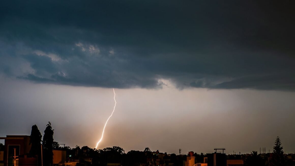
Environment Canada lifts thunderstorm warning for Montreal after severe storms sweep region
Environment Canada lifted its severe thunderstorm warning for Montreal and Laval Tuesday evening, closing out several hours of high winds, hail and heavy rain that knocked out power to thousands of homes across the West Island. The warning covered Montreal Island and neighboring Laval at the height of the storm, with meteorologists flagging damaging wind gusts, large hail and the risk of a tornado before conditions eased after nightfall.
If you’re in Montreal right now, the immediate danger has passed. But Hydro-Québec crews are still working through outages in Pointe-Claire, Kirkland, Dollard-des-Ormeaux and Beaconsfield, and you should expect residual hazards like downed branches and standing water on some roads into Wednesday morning.
Key takeaways
- The severe thunderstorm warning for Montreal and Laval was lifted Tuesday evening after Environment Canada confirmed the worst of the storm cell had moved east of the region.
- Hydro-Québec crews were dispatched to Pointe-Claire, Kirkland, Dollard-des-Ormeaux and Beaconsfield, where wind and falling trees caused the bulk of the damage to distribution lines.
- Treat every downed line as live. Hydro-Québec asks residents not to approach or move a fallen line, and to report it by calling 1-800-790-2424.
- Before resuming outdoor plans, inspect your property for loose branches, flooded low points and damaged fencing that the storm’s wind gusts may have left behind.
- Monitor Environment Canada’s alert page directly rather than relying on secondhand social media posts, since watches and warnings can be upgraded or lifted within a narrow window.
Timeline: how Montreal’s severe thunderstorm warning unfolded
When the warning was issued and what triggered it
Environment Canada issued a yellow severe thunderstorm watch for the Greater Montreal area earlier Tuesday, warning of gusts reaching potentially damaging speeds, hail and torrential rain, according to weather alerts tracked for the Montréal Island area. The watch was upgraded to a full warning as the storm cell intensified and moved into the region, a step Environment Canada takes only when meteorologists confirm severe weather is imminent or already occurring, rather than merely possible.
The setup fit a pattern already seen repeatedly across Montreal’s severe weather this August. Instagram weather account MTL ONLY posted as the watch went into effect: “Montreal is under a severe thunderstorm watch, with Environment Canada warning of damaging wind gusts, hail, torrential rain, and even a” tornado risk for parts of the region.
When Environment Canada lifted the warning
Environment Canada lifted the severe thunderstorm warning for Laval and Montreal Island Tuesday evening once the storm cell had cleared the metro area and wind speeds dropped below warning thresholds. This mirrors an earlier watch this same season that Environment Canada also lifted Tuesday evening, when the city ended up receiving only light rain rather than the severe conditions initially forecast. That earlier event is a reminder that a watch or warning reflects the potential for severe weather within the forecast area, not a guarantee every neighborhood will see the worst of it.
West Island power outages: Hydro-Québec’s response and restoration
Scope of outages across Pointe-Claire, Kirkland, Dollard-des-Ormeaux and Beaconsfield
The West Island bore the brunt of the storm’s impact on infrastructure. Pointe-Claire, Kirkland, Dollard-des-Ormeaux and Beaconsfield all reported outages as wind gusts brought branches, and in some cases full trees, down onto distribution lines. These four municipalities sit along a corridor that has seen repeated exposure to summer storm damage in recent years, partly because of mature tree canopy close to overhead lines.
| Municipality | Reported impact | Primary cause |
|---|---|---|
| Pointe-Claire | Multiple outage pockets | Downed tree limbs on lines |
| Kirkland | Residential blocks affected | Wind-related line damage |
| Dollard-des-Ormeaux | Scattered outages | Fallen branches |
| Beaconsfield | Localized power loss | Tree contact with distribution lines |
Hydro-Québec restoration timeline and crews deployed
Crews reached the affected West Island sectors as the storm moved through, prioritizing lines feeding critical infrastructure before working through residential blocks. If your street lost power, expect restoration to happen in phases rather than all at once, since crews typically clear hazards and restore high-voltage feeders before reconnecting individual homes.
You can check real-time outage maps on Hydro-Québec’s website or mobile app rather than waiting on hold, and you should report any downed line you see immediately by calling 1-800-790-2424. Do not assume a line is dead just because the power in your home is out: nearby circuits can remain energized even during a local outage.
Storm damage and impact across Greater Montreal
Wind gusts, hail and rainfall totals recorded
The storm brought the combination Environment Canada had flagged in its watch: damaging wind gusts, hail and heavy rain moving through the Greater Montreal area within a compressed window. The severe thunderstorm watch issued by Environment and Climate Change Canada (ECCC) specifically warned of gusts capable of causing structural and vegetation damage, consistent with the downed trees reported on the West Island.
Flooded roads, downed trees and reported disruptions to transit
Heavy rain over a short period left some low-lying roads temporarily flooded, a common outcome when Montreal’s storm drains can’t keep pace with sudden downpours. Downed trees and branches, concentrated in the West Island municipalities hit hardest by wind, blocked some secondary roads and contributed to the power outages described above. If you commute through Pointe-Claire, Kirkland, Dollard-des-Ormeaux or Beaconsfield, check road conditions before heading out, since cleanup crews may still be clearing debris.
Context: Montreal’s severe weather pattern in August 2026
How this storm compares to earlier summer 2026 watches and warnings
This isn’t an isolated event. Montreal has cycled through multiple severe thunderstorm watches and warnings over the course of summer 2026, a pattern consistent with the region’s typical late-July and August storm season, when warm, humid air masses collide with cold fronts moving in from the west. Environment Canada’s own historical alert archive, which logs every weather alert and warning issued for Montreal since July 2008, shows this kind of clustering is common during peak summer months rather than an anomaly for this particular year.
What Environment Canada’s yellow watch versus warning levels mean
A yellow watch means conditions are favorable for severe thunderstorms to develop, but they haven’t yet formed or arrived. A warning means severe weather is either imminent or already happening, and you should take immediate precautions. Environment Canada moved from watch to warning status Tuesday as the storm cell developed the wind, hail and rain intensity that meets its warning criteria. A watch is your cue to stay alert and make a plan; a warning is your cue to act, get indoors, secure loose objects and avoid travel if possible.
What residents should do now that the warning is lifted
Checking for residual hazards before resuming outdoor activity
The warning being lifted doesn’t mean every hazard is gone. Walk your property before letting kids or pets outside unsupervised, checking for weakened tree limbs that could fall without further wind, standing water that may hide debris, and any exposed wiring near your home. If you spot a downed line anywhere, even one that looks inactive, stay back and call it in rather than assuming it’s safe.
How to monitor future alerts from Environment Canada
Given how frequently watches and warnings have cycled through Montreal this summer, check Environment Canada’s alert page directly, or Hydro-Québec’s outage map if you’re specifically tracking power restoration, rather than relying on aggregated apps that can lag behind official updates by several minutes. AccuWeather and similar services also track Montreal-specific advisories continuously, but Environment Canada remains the authoritative source for when a watch or warning is issued, upgraded or lifted.
Frequently asked questions
Why is the sky yellow right now in Montreal?
A yellow or greenish tint to the sky during a thunderstorm usually indicates a high concentration of moisture and hail suspended in the storm cell, often combined with the angle of sunlight filtering through thick cloud cover. It’s frequently associated with severe storms capable of producing large hail or, in rarer cases, tornadoes, which is why Environment Canada flagged tornado risk alongside its severe thunderstorm watch for this event.
What is the weather like in Montreal today?
Conditions have stabilized following the storm’s passage, with the severe thunderstorm warning lifted Tuesday evening. Residents should still expect localized cleanup, including debris on West Island streets and possible lingering power restoration work, even as skies clear.
Will summer 2026 be hot in Montreal?
Montreal’s summer 2026 has already shown a pattern of warm, humid conditions punctuated by multiple severe thunderstorm watches and warnings, consistent with typical seasonal heat-and-storm cycles for the region. Specific long-range temperature forecasts should come from Environment Canada’s seasonal outlooks rather than short-term storm coverage.
Was there a tornado warning issued for Montreal during this storm?
Environment Canada’s watch flagged tornado risk as a possibility alongside damaging wind gusts and hail, but the alert that was ultimately issued and later lifted was a severe thunderstorm warning, not a separate tornado warning. Watches that mention tornado potential don’t automatically escalate to a tornado warning unless a tornado is confirmed or strongly indicated by radar.
How can I check current weather warnings for Montreal?
Go directly to Environment Canada’s public alerting page for Montréal, QC, which lists all active alerts, watches and warnings in real time. AccuWeather’s Montreal warnings and advisories page offers a secondary check, though Environment Canada issues and lifts the official alerts first.
If you’re on the West Island and still without power, your fastest path to an update is Hydro-Québec’s outage map, not a call center. Bookmark both that and Environment Canada’s alert page now: with Montreal’s storm pattern this August, you’ll likely need them again before summer’s out.